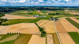
Conny Waters – AncientPages.com – Rivers in the Mesopotamian floodplain have historically served as the primary water source for irrigation, essential for agricultural practices. Early farmers needed to master basic techniques to divert river water to their fields. These skills evolved from simple methods, like digging short canals over crevasse splays, and gradually advanced through accumulated knowledge and experience passed down through generations, eventually leading to the construction of canals stretching up to 100 kilometers long.

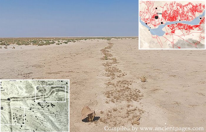
Ground-truthing of the remote sensing work: A) drone images show two minor irrigation canals; B & C) photographs of the two small canals (figure by authors). Credit: Antiquity (2025). DOI: 10.15184/aqy.2025.19
Two key geomorphological features made these rivers manageable for early agriculturalists. Firstly, the rivers’ elevated levees allowed water to flow naturally by gravity onto the surrounding farmland. Secondly, crevasse splays—natural or artificially created breaks in the river levee—enabled direct water release onto the floodplain via fissure channels.
Despite these advancements, much of what we know about irrigation and farming in southern Mesopotamia is derived from indirect evidence such as texts on cuneiform tablets, but a new study can shed more light on this subject.
Researchers have made a significant discovery in the Eridu region of southern Mesopotamia, revealing a vast and well-preserved network of ancient irrigation canals. This finding provides valuable insights into early farming practices. Led by geoarchaeologist Jaafar Jotheri, the research team uncovered an extensive water management system that dates back to before the first millennium B.C.
The study offers rare perspectives on how farmers from the sixth century to the early first millennium BC utilized the Euphrates River for field irrigation. This discovery not only deepens our understanding of ancient irrigation systems but also underscores the ingenuity and adaptability of early agricultural communities.
The Eridu region, located near Basra in modern-day Iraq, remained preserved for centuries due to a shift in the Euphrates River’s course during the early first millennium BC. This change left the area dry and uninhabited, maintaining its ancient landscape unlike other Mesopotamian regions where older irrigation systems were buried under newer developments.

The reconstructed irrigation canal network in context with the ancient Euphrates riverbed and the archaeological sites of the Eridu region. The base map is a Corona satellite image. Credit: Antiquity (2025). DOI: 10.15184/aqy.2025.19
Researchers have identified over 200 primary canals directly linked to the ancient Euphrates through geological maps, satellite imagery, drone photography, and fieldwork. Additionally, they mapped more than 4,000 smaller branch canals connected to over 700 farms.
This intricate irrigation network showcases the advanced water management skills of ancient Mesopotamian farmers who effectively utilized their natural surroundings. The high river levees allowed gravity-fed water distribution to nearby fields while breaks in these levees—known as crevasse splays—helped spread water across floodplains. These methods enabled cultivation on both sides of the river; however, farming was more intensive on the northern side.
See also: More Archaeology News
The study also reveals how this irrigation system evolved over time. Maintaining these canals required substantial labor and expertise, indicating that different sections were likely used at various periods. Ongoing research aims to date each canal for a deeper understanding of the evolution of historical farming practices’ evolution. Comparing canal designs with descriptions from ancient cuneiform texts could further illuminate agricultural management strategies in Mesopotamia.
The study was published in the journal Antiquity
Written by Conny Waters – AncientPages.com Staff Writer