JAKARTA — The Indonesian government is targeting protected forest areas as part of its plan to convert 20 million hectares (50 million acres) of forest into “food and energy estates,” a move that could result in the largest deforestation project in the country’s history.
The inclusion of protected forests in this initiative has sparked concerns over biodiversity loss and environmental degradation.
Out of Indonesia’s 27 million hectares (66.7 million acres) of protected forests, the Ministry of Forestry has identified 2.3 million hectares (5.7 million acres), an area 30 times the size of New York City, that could be converted for food and biofuel crop production, according to an official document analyzing the plan.
These protected areas are part of a broader 20.6 million hectares (50.1 million acres) of forestland the government deems suitable for food and energy estates.
Protected forests in Indonesia are designated to preserve biodiversity, maintain ecological functions and safeguard watersheds, which is why activities such as large-scale agriculture and mining are typically restricted within them.
The decision to open these forests for conversion has raised alarms among environmental groups and lawmakers.
“This is a surprise because protected forests should be for conservation, not for food,” said Amalya Reza Oktaviani, bioenergy campaign manager at the NGO Trend Asia. She attributed the government’s interest in protected forests to the sheer scale of the project, which spans an area twice the size of South Korea.
The risks of deforestation in these areas are high, as protected forests still contain significant natural forest cover, she said. Official data from 2020 show that 81.7% of protected forests remained intact, making them the category of forest with the highest tree cover in the country.
Lawmakers have also voiced their opposition, with Hanan Rozak of the Golkar Party urging the government to maintain the protection status of these forests and refrain from using them for agriculture.
“Don’t disturb protected forest areas. Please maintain [their protection status]. Don’t use them for agricultural activities, don’t plant them with corn, rice and so on,” he told forestry ministry officials during a parliamentary hearing Jan. 23. “So please, really evaluate [this plan].”

Government justifications
Forestry Minister Raja Juli Antoni has defended the plan, framing it as an effort to rehabilitate degraded protected forests. He stated that the targeted areas are not pristine rainforests but rather denuded lands that have lost their tree cover due to industrial logging, encroachment and forest fires. The 2.3 million hectares of protected forests, he argued, are already degraded and would be reforested through agroforestry.
Government data estimate that around 4 million hectares (9.9 million acres) of land within protected forests are degraded. Raja insisted that since these lands lacked intact forest cover, their conversion would not result in deforestation.
The government also said that implementing agroforestry, in which food crops are interspersed among trees, would minimize deforestation risks.
“The fact is that 2.29 million hectares of our protected forest areas have been cleared. So we reforest [them] with agroforestry,” he said during the parliamentary hearing. “We can plant upland rice and so on. This is part of our strategy to rehabilitate protected forest areas that have been denuded all over [the country].”
Medrilzam, acting director of forestry at the national development planning agency (Bappenas), argued that leaving degraded forests untouched could lead to further encroachment, fires and illegal mining.
“How could we leave degraded forests as they are? What happens [if we do that] is that they will be further encroached, burned, become illegal mines, etc.,” he told Mongabay.
To mitigate these risks, the government plans to apply environmental safeguards. If protected forest areas are used for food and energy estates, communities will be allowed to harvest only non-timber forest products to ensure that forest integrity is maintained, Medrilzam said.
“So it doesn’t mean that there should be no activities in protected forest areas at all,” he said. “But the mechanism is social forestry and non-forest timber resources. So the forests can’t be cleared.”
Medrilzam emphasized that the final figure for forest area conversion is still being assessed, with certain areas, such as those containing peatlands or high conservation value ecosystems, potentially being excluded.
“We will continue to trim down the figure and verify the forest areas to determine their suitability [for food and energy crops],” Medrilzam said.

Challenges to the government’s claims
Despite these assurances, critics remain skeptical. Lawmakers have questioned whether food crops such as rice can be successfully cultivated in protected forests, even if the land is degraded. Many of these forests are located in regions with steep slopes, sensitive soils and high rainfall, making them unsuitable for agriculture.
While it is technically possible to plant upland rice on steep land, the primary function of protected forests is to regulate water cycles, prevent erosion, absorb carbon and serve as habitats for diverse flora and fauna, according to Timer Manurung, director of Indonesian environmental NGO Auriga Nusantara.
He said that true rehabilitation should focus on restoring native tree cover rather than planting food crops that require extensive sunlight and open land.
Agroforestry can be an option, but only if trees remain the dominant cover and tree species that provide food, such as fruit trees, are prioritized rather than short-term crops like rice and corn, which require clear-cut land, Timer said.
“How can rice grow [in dense forests]? They need sunlight, right? So the idea of planting rice on forested lands don’t make sense,” he told Mongabay.
Moreover, a 2020 government regulation on forest rehabilitation stipulates that restoration efforts should prioritize native tree species, maintain continuous forest cover and prohibit land conversion for non-forest use, including agriculture.
This raises questions about whether the government’s plan genuinely qualifies as “rehabilitation” under existing legal frameworks.
Focusing on the reforestation aspect of degraded forests in Indonesia is particularly important considering the country’s role in fighting climate change, said Uli Arta Siagian, forests and plantations lead at the Indonesian Forum for the Environment (Walhi), the country’s biggest green NGO.
Indonesia has the third-largest tropical forest area in the world, after Brazil and the Democratic Republic of Congo. These forests store vast amounts of carbon, but they can also release huge amounts of greenhouse gas emissions when they’re cleared.
Due to deforestation and peatland degradation, which accounted for nearly half of the country’s total emissions over the past 20 years, Indonesia is one of the largest carbon emitters.
Given that the planet keeps moving closer to breaching the 1.5° Celsius (2.7° Fahrenheit) temperature rise, it is more important now than ever for Indonesia to protect its remaining forests and reforest its degraded lands, as they’re one of the most cost-effective ways to reduce emissions, Uli said.
“If the government argues that they are utilizing forest areas that are no longer forested, then based on Indonesia’s international climate commitments and the need to address climate change, those areas should be reforested, not converted into plantations,” she said.
Lack of transparency
Another major issue is transparency.
The government has yet to disclose the exact locations of the 20.6 million hectares slated for food and energy estates, making it difficult to verify claims that these areas are degraded, Timer pointed out.
Public access to these data is crucial to ensure that genuinely intact forests are not mistakenly included, he said.
Full disclosure of the location is also important to avoid potential conflicts with local and Indigenous communities, considering that many of them live within and around forest areas, Timer added.
Official data from 2019 show that nearly 26,000 villages with 9.2 million households are located within or near forest areas.
This lack of clarity raised the question of whether there’s a need for 20.6 million hectares of food and energy estates in the first place, according to lawmaker Alien Muhammad Taher Mus.
“We asked the agriculture ministry, and they said that the need for food availability in our country is 1-3 million hectares [or 2.5-7.4 million acres of new agricultural fields], if I’m not mistaken,” she said, questioning what the rest of the 20.6 million hectares would be for.
Raja said the ministry already has maps on the locations of the identified forest areas as well as data on the condition of the forest areas.
“I won’t dare to talk without data,” he said.

A history of failed food estate programs
Skepticism is further fueled by Indonesia’s past failures in large-scale food estate projects. The Mega Rice Project of the 1990s, which sought to convert 1 million hectares of peatland in Central Kalimantan into rice fields, ended in ecological disaster. The project was abandoned after large-scale deforestation, draining of peatlands, and failed rice yields left the region vulnerable to fires and floods.
In the 2010s, the Merauke Integrated Food and Energy Estate in Papua aimed to produce rice, corn, sugar and palm oil. Despite promises of diverse crops, much of the land was ultimately converted into monoculture plantations dominated by oil palm and sugarcane, leading to deforestation and social conflicts with Indigenous Papuans.
The most recent attempt, under former President Joko Widodo in the early 2020s, focused on monocultures like rice and cassava and also failed due to poor planning, unsuitable land selection and lack of infrastructure.

Current deforestation
Despite government assurances that no deforestation will occur, recent food estate projects in Merauke have already resulted in forest clearance. Two projects are currently underway: one involving 2 million hectares (4.9 million acres) of sugarcane plantations and another converting 1 million hectares into rice fields. Satellite monitoring by Greenpeace Indonesia found that 2,527 hectares (6,244 acres) of land in one sugarcane concession had already been cleared. Separately, data from technology consultancy TheTreeMap show that more than 4,200 hectares (about 10,380 acres) of forests were cleared as of December 2024 for road and port infrastructure supporting the rice project.

Given these ongoing developments, Leonard Simanjuntak, the country director of Greenpeace Indonesia, argued that the government’s claim that food estates would not lead to deforestation was contradicted by the realities on the ground.
“So if we look at what’s happening in Merauke, it means that there’s surely going to be deforestation,” caused by the 20.6 million hectare food and energy estate plan in forest areas, Leonard told Mongabay. “So the statement [made by the forestry minister] is immediately rebuked by what’s happening now [in Merauke].”

Legal and political landscape
The decision to allocate protected forests for agriculture follows recent policy changes that have weakened environmental safeguards.
The omnibus law on job creation, passed in 2020, removed several restrictions on forest use for commercial purposes.
A separate forestry ministry regulation issued that same year allows large-scale food estate development in protected forests without requiring them to be rezoned.
If the food and energy estate project is classified as a project of strategic national importance (PSN), it could bypass additional regulatory hurdles, fast-tracking approvals and limiting oversight, Leonard said.
Therefore, categorizing this project as a PSN would set a dangerous precedent, allowing large-scale environmental destruction with minimal accountability, he said.
The project “becomes much more problematic” if it’s a PSN, Leonard said, as there are cases of “PSN projects evicting people left and right. … Some PSN projects are problematic as they overrule regulations. Just imagine what can be overruled with the 20.6 million hectare project. Maybe all spatial planning will be violated.”
Medrilzam of Bappenas said the government planned to categorize the food and energy estate project in forest areas as a PSN, with focus on reforesting degraded forests while planting food crops at the same time.
“Hopefully this [project] will become a PSN,” he said.
Go back to the drawing board
With mounting criticism, environmentalists and civil society groups urge the government to reconsider its approach.
Instead of top-down planning that favors agribusiness, they argue for policies that prioritize smallholder farmers and Indigenous communities, who have historically contributed more to food security than large-scale industrial plantations.
Ensuring local participation, restoring degraded lands with native tree species and protecting remaining intact forests should be the priority, said Ahmad Martin Hadiwinata, national coordinator of FIAN Indonesia.
“Many countries depend on small farmers and family farmers for their food security, not massive industrial projects with significant economic and social risks,” he said.
To make sure that communities are included in the food and energy estate program, the government should examine whether the forest areas that it has identified overlap with community lands or ancestral lands or not, Uli said.
“In that case, community involvement in environmental restoration should be prioritized. This would ensure both the recognition of land rights and the acknowledgment that communities play a key role in protecting forests,” she said.
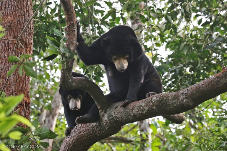
Banner image: The Ulu Masen-Leuser Tiger Conservation Landscape houses many other species, including Sumatran orangutans. Image by Rhett A. Butler / Mongabay. Image by Rhett A. Butler / Mongabay.
FEEDBACK: Use this form to send a message to the author of this post. If you want to post a public comment, you can do that at the bottom of the page.